Globe Simulator Project v0.1
A downloadable tool
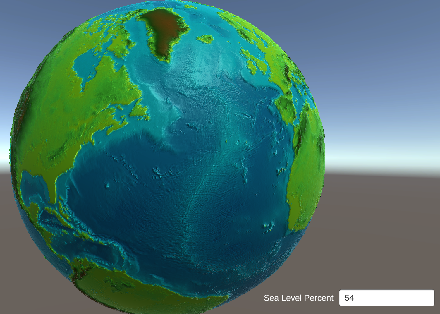
This program is the initial step in creating a means of simulating climate by extrapolating from a heightmap. Currently, its primary function is to create a 3D globe from heightmap images.
How to use:
When the program launches, you will be asked to import a file. This can be any grayscale heightmap, but for illustrative purposes I have left a suitable jpeg in this folder, composed of some basic heightmap and bathymetric data. Once you have selected an image, click the Confirm button to generate the globe! You can use the WASD keys to rotate the globe, and the scroll button on the mouse to zoom in and out. Additionally, in the bottom left is a numerical input box. This determines where the globe draws sea level, as a percentage of the total "height" of the image. If you wish to change this, or reset your viewpoint to the default view, press Spacebar to regenerate the globe.
Image Credits: Some of these images are derived from heightmaps created by Niels Elling Wisth for his world Theia.
Download


Leave a comment
Log in with itch.io to leave a comment.